



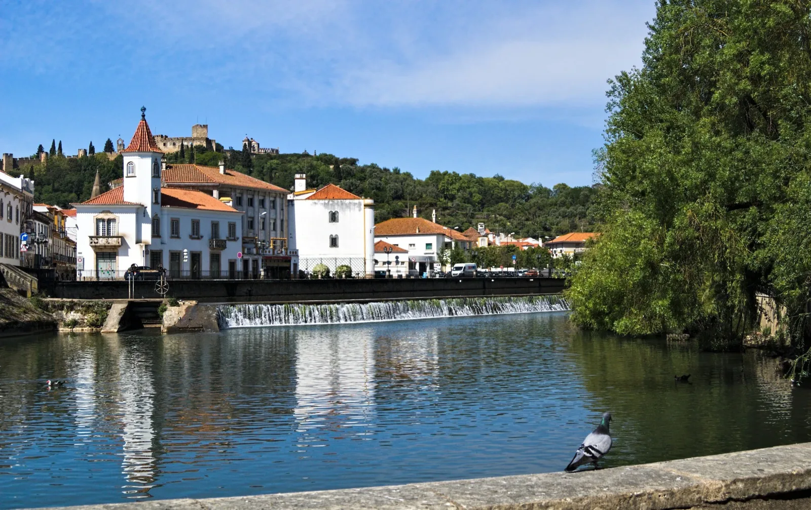

Connect the hilltop enclosure, early lower-town streets, changing public settings and working river edge. Historical interpretation, reviewed 19 November 2026.
Nabao river in Tomar, a contextual view of the river, lower town and hilltop enclosure, not a reconstruction of an earlier urban phase. Photograph: Juntas / Wikimedia Commons, CC BY-SA 4.0 International. Resized from 3000x1887 to 2400x1510 and recompressed; no crop. This image version is available under CC BY-SA 4.0.

The lower town was not simply a fifteenth-century creation
Tomar's hilltop enclosure and the streets between its slope and the Nabao belong to connected histories. Luisa Trindade's urban-history research identifies evidence for lower-town streets in the late twelfth century and further occupation in the following centuries. The lower settlement was not simply created when later rulers enlarged the religious complex above it.
This matters because the regular arrangement of streets has often been associated with Henrique's fifteenth-century administration of the Order of Christ. Trindade explicitly challenges that explanation. Drawing on earlier research, especially Manuel Silvio Alves Conde's work, she distinguishes an earlier lower-town framework from later expansion and new public settings. An orderly plan need not have the late date suggested by its appearance.
The upper enclosure had contained civilian housing as well as the Order's premises. Conde describes the Almedina as an inhabited fortified settlement, but stresses how little secure evidence survives for its internal streets and buildings. His proposed street relationships respond to the slope and surviving boundaries; they are not a complete recovered plan of the vanished neighbourhood.
The useful starting point is therefore neither a finished castle above an unrelated town nor one ruler moving an entire settlement onto empty ground. Upper occupation and lower growth overlapped. Their relative roles changed, and later institutional building altered the relationship again. The account requires both early evidence and the limits of its reconstruction.
Streets joined the hill approaches, crossing and working ground
Trindade places the Corredoura within a longer connection between the hilltop fortress, river crossing and routes beyond the river. The street was not merely an internal line in a neat grid. Its relationship with the crossing joined the lower town to a wider territory, including the direction of Santa Maria do Olival. This is a historical spatial relationship, not a present walking route.
The lower ground also had more than one focus. Conde describes Pe da Costa at the foot of the hill and Ribeira beside the river. The latter's access to water power helped make difficult riverside ground useful for production. These places had different relationships to terrain and work even as streets connected them within the growing settlement.
Trindade's proposed initial matrix uses the Corredoura and Riba Fria, together with the Rua dos Moinhos and Rua Direita, to interpret a more regular occupied area. She distinguishes it from the adjoining hill-foot and working riverside settlements. Her method combines reported documentary references, the later property framework, place names and comparison. The exact initial boundary is a scholarly hypothesis, not an original survey independently checked here.
That distinction prevents the town becoming a single diagram. Named streets are reported in early documents, but their evidence does not establish the original dimensions of every block or the history of every plot. Likewise, a mill-related street name does not locate every medieval machine. The stronger relationship is among routes, occupied ground, topography and the productive river edge.
Later work changed the edges and public settings
The fifteenth-century works were important without having created the entire lower town. Trindade places much of that intervention around an inherited framework: new occupation towards Varzea Pequena, productive premises by the river, the Estaus and Rua dos Arcos to the south, and a changed public setting by Sao Joao. Expansion and new centralities were different from replacing every earlier street.
The Estaus connected accommodation with a trading setting. Trindade relates the buildings to lodging for the master's following and people coming to the fair, while the arcades helped define Rua dos Arcos. Her account uses later descriptions and earlier scholarship to reconstruct the arrangement. It also describes an interrupted programme, so the intended upper accommodation must not be presented as a wholly completed building scheme.
River work likewise changed the possibilities for building. Trindade connects work on the Mouchao channel with draining Varzea Pequena and making ground available for further houses. Jack's later industrial-archaeology study also relates canal-side reclamation, housing and the productive island. Early documented mills do not, however, establish the date or form of every later channel and weir.
Public centrality changed within the lower settlement too. Trindade connects the Sao Joao setting with later institutional works and the movement of the pillory. The heritage inventory describes successive alterations to the municipal building. The accounts do not establish one uncontested original building sequence, but they do support a civic setting made and changed over time rather than inserted once into a finished town.
A larger religious enclosure changed residential occupation
Changes above were more than additions to a skyline. Conde describes the Almedina losing ground as a residential setting while the lower town became more important. He then relates the ending of its role as an urban neighbourhood to the conversion of the enclosure for conventual life. The history joins the use of land with the changing institution, not merely the style of its buildings.
Conde and Marques both describe the movement of lay residents from the upper enclosure and Sao Martinho into the lower town, but give different exact years. No single year is adopted here. The supported scale is the late-fifteenth-century transformation and reported transfer below. It is not evidence that every household moved under the same conditions.
Marques connects the religious reforms and expansion of convent buildings with a need for premises suited to the Order's changed life. This helps explain why the upper enclosure could cease to function as the same kind of mixed settlement. It does not establish the internal plan of every lost dwelling or turn later convent buildings into unchanged remains of the civilian town.
Nor should the transfer become a simple improvement story. These sources do not establish every resident's consent, compensation or later welfare. Important streets and institutional buildings can be evidence of effective spatial intervention without proving benevolent government. The architectural point is that the upper enclosure and the lower residential town changed together, not that everyone experienced those changes equally.
A proposed factory reveals competing claims on the river
A later building proposal makes control of the river more concrete. Clara Marques studies Bernardo Daniel de Moraes's 1799 request for paper works at the Prado site, using premises associated with an earlier furnace. This is a particular development proposal, not the origin of Tomar's whole industrial landscape and not the later paper company with which it might be confused.
The request involved other interests already depending on the river. Marques describes the friars asserting rights over the weir and objecting that the proposal would harm milling, pressing and irrigation. She also records claims about raising water, flood damage and the interests of the Crown and population. These are positions advanced in a dispute, not independently measured consequences of a factory that had been built.
The outcome has a firm evidential limit. Marques states that the manuscript does not give the final decision, and her inference that the proposed industry was not established is not a surviving refusal order. The document supports an account of contested development and asserted privileges. It cannot prove a universal monopoly operating without exception or that every objection succeeded.
Physical premises also changed independently of proposals. Jack's 1988 field and documentary study describes repeated rebuilding, reuse and replacement within the productive riverside area, including later mills and electricity generation. Those are dated observations, not a promise that machinery still operates or a claim that today's buildings preserve one complete medieval arrangement. Control, building alteration and continued use require different evidence.
The river became a connection within a larger city
The earlier lower-town framework did not remain the outline of all later Tomar. Valla's landscape account follows development beyond the old core and across the Nabao. Read beside the municipality's 2014 urban analysis, it places the river within a larger built settlement rather than treating the productive island as the town's final edge. This is not a complete chronology of every later district.
The 2014 municipality describes the historic centre alongside adjoining areas with different built forms and periods of development. Its strategic discussion treats connections among the east-bank urban nucleus, historic centre and Convent of Christ as a continuing planning question. Those objectives belong to a dated proposal. Their publication does not establish that every connection or intended improvement was completed.
This changes how the earlier relationships are understood. The crossing belonged to routes extending beyond the lower streets; river works affected occupied ground; institutions changed both upper enclosure and lower settings; and later development made the older core part of a wider city. None of those relationships requires every street, building or use to have one date or one author.
Tomar is therefore clearer as a changing relationship among enclosure, streets, public settings, productive ground and the ability to build. Early lower-town evidence must remain distinct from proposed reconstructions, later works from original foundations, and competing claims from proven outcomes. The historical sources do not establish present operations, legal rights, physical conditions, access or the success of later planning.
Sources
- Trindade (2009), Tomar text and notes pp503-510
- Conde (2012), bounded returned chapter text through p291 and opening p292
- Marques (2021), industrial development and the 1799 proposal
- Jack (1989), water power and industrial premises, 1988 fieldwork
- Valla (2017), Tomar cultural landscape, paragraphs31-41
- Municipality (2014), ARU analysis and objectives, sections1.2-1.3
- SIPA, municipal building, IPA.00002034, bounded building evidence
Questions people ask at the gate
Did Henrique create the entire lower-town street plan?
That is not the interpretation adopted here. Trindade uses early street references and earlier research to argue for lower-town development in the late twelfth and thirteenth centuries. She places many fifteenth-century changes around an inherited framework. Important later works should not be confused with the original creation of every street.
Is the original lower-town grid completely documented?
No. Early named streets are reported in documents, but Trindade's proposed initial boundaries and matrix combine that evidence with later property patterns, place names and comparison. They are a scholarly reconstruction, not a complete original survey or an independently inspected plan of every medieval plot.
What did the Estaus add to the town?
The account relates accommodation, arcades and Rua dos Arcos to the lower town's trading setting. It draws on later descriptions and earlier scholarship, and describes an interrupted programme. The intended lodging arrangement should therefore not be treated as wholly completed exactly as first proposed.
When did civilian occupation of the upper enclosure end?
The sources used here give different exact years for the late-fifteenth-century change. This account retains the broader transformation for conventual use and reported transfer of residents below, without choosing a year or claiming that every household shared the same experience, consent or outcome.
Was the 1799 paper-factory request definitely refused?
The manuscript's final decision is not stated in Marques's account. She infers that the proposed industry was not established, but that is not a surviving refusal order. The parties' claims about rights, water shortage, damage and public interest likewise remain arguments within a dispute, not proven consequences.
Do the sources establish present mills or completed urban improvements?
No. Jack describes 1988 fieldwork, and the municipal 2014 report sets out dated analyses and objectives. Neither establishes today's operation, building condition, access, legal entitlement or completion of every intended connection. Historical river uses and planning ambitions are not a current inspection or visitor arrangement.
Next walk starts at a new gate.
Was this helpful?
one tap, no sign-up

A Miranda House graduate and lawyer who traded courtrooms for slow travel. Cheshta travels with the batches we host ourselves, with a soft spot for travelling alongside elders.