




Historical research supports this interpretation, not a current access, safety or visitor-services survey. Proposed schemes are distinguished from executed work. Incomplete documents, reconstructed plans and small memory projects do not establish the experience of every household. Reviewed 19 November 2026.
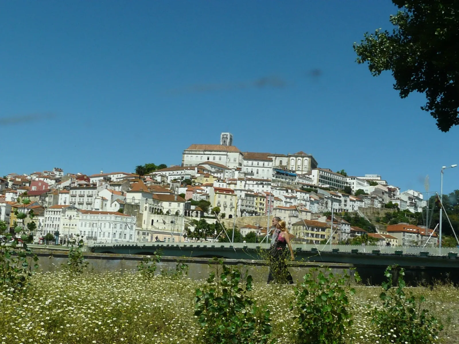
Coimbra from across the Rio Mondego, a contextual city view, not a reconstruction of any earlier phase. Photograph: Varun Shiv Kapur / Wikimedia Commons, CC BY 2.0. Recompressed; no resizing or additional crop. No endorsement implied.

A lower centre existed before the university's definitive settlement
Coimbra's upper settlement and lower town cannot be explained as a campus and its service district. Octavio Augusto's research on the medieval Baixa describes commercial streets, parish ground and a developing civic centre before the university's definitive sixteenth-century settlement. The Alta, on higher ground, already contained an inhabited town. Later educational building entered these older relationships rather than creating the whole city around itself.
The lower square's formation was a process, not an original empty rectangle waiting for public buildings. Augusto distinguishes references to markets near churches from evidence for the later square's shape. His account of enlargement involves properties, demolition and municipal intervention. A market reference does not by itself prove that today's Praca do Comercio already existed with the same extent and edges.
Civic activity also did not move downhill in one complete transfer. Augusto follows different meeting places and distinguishes an intended municipal premise from evidence of its occupation. Streets, the square, adjoining buildings and the Calçada formed a changing setting for public business. His spatial reconstruction draws on incomplete documents and later evidence; it should not be mistaken for a surviving medieval survey of every frontage.
Nor was the Baixa a socially uniform merchants' quarter. Augusto's bounded property and social discussion includes craftsmen, traders, office-holders and clergy. The useful distinction is between connected concentrations of activities, not two sealed populations above and below. This older lower centre matters because later college building and nineteenth-century public projects had to work with established properties, routes and commercial habits.
Sofia joined college ground with a housing programme that changed
The sixteenth-century university project did not begin with the arrangement later associated with the Alta. Walter Rossa's study of Sofia follows plans for an educational setting on lower ground, close to Santa Cruz. The programme joined colleges with accommodation for teachers, students and staff. Forming the street meant changing property relationships and working with terrain and access, not simply laying matching facades along an untouched line.
Rossa distinguishes the higher studies established above from colleges and preparatory teaching below. The proposals changed, educational functions shifted, and the university grew in the Alta. Sofia therefore cannot be described either as a complete university campus subsequently moved uphill or as a street where education never happened. Different kinds of teaching, college life and institutional accommodation followed different paths.
Housing was part of that urban programme. Rossa describes contracts regulating the timing and form of house construction, but also slow building, reverted properties and renewed transactions. The intended relationship between college premises and rented dwellings did not guarantee a street completed promptly to one uniform design. A formal rule tells us what was sought, not that every owner built at once or that every frontage remained unchanged.
The relationship between the two sides changed too. Colleges proposed on one side and housing on the other did not become a permanent division: later religious building also occupied western ground. Within college premises, cloisters organised circulation and shared life, but the colleges did not all have an identical layout. Street frontage, internal community and adjoining housing must be read together without imposing a single recovered master plan.
Sofia also belonged to the wider town's approaches. Rossa relates its formation to a northern connection and difficulties affecting lower routes during floods. That historical role exceeded service to one institution. As university facilities expanded above, the lower street remained part of the Baixa's structure. Its history is one of an ambitious educational proposal changing within a city, not a failed diagram left outside urban life.
Former religious property did not become a finished civic centre overnight
The nineteenth-century suppression and appropriation of religious property opened another relationship between institutional enclosure and the city. Margarida Relvao Calmeiro's study follows Santa Cruz after 1834, distinguishing the broad intentions put forward in 1835 from the more limited assets and uses actually conceded. Educational, civic and other public ambitions did not all become buildings simply because they appeared in a programme.
Early occupation could be modest. Calmeiro describes partitions, stairs and practical adaptation within former premises, together with renting portions to help maintain the complex. These measures differ from the later construction of a new municipal setting. An institution closing, rooms receiving new occupants and a major architectural project being completed are separate stages, each with its own resources and constraints.
The older lower centre continued to shape choices. Moving the market towards Santa Cruz met objections about distance from familiar trading circuits. Alternatives nearer the established Baixa and river were considered, but their expense mattered. The decision was therefore not simply a planner discovering an obviously superior empty site. It involved accustomed journeys, competing locations and the cost of making public space.
This sequence changes how the former monastery should be understood. Its buildings offered rooms that could be occupied before a larger scheme was affordable; its grounds offered possibilities beyond those rooms. Neither opportunity automatically determined what followed. The older commercial setting, selective grants, maintenance needs and contested priorities shaped the pace and form of conversion. Later expansion cannot be projected backwards as the inevitable outcome of 1835.
A market, municipal building and former estate changed wider connections
The market opened in 1867, but opening a facility did not settle every argument about its location or immediately make all surrounding ground a successful new centre. Calmeiro places it within a longer reorientation of activity around Santa Cruz. The important connection is between a new trading setting and the city's changing extent, while keeping the earlier resistance and financial reasoning visible.
The new city hall required partial demolition and provoked arguments over expense, priorities and the treatment of inherited buildings. This was not the disappearance of the entire monastery. Nor did the first municipal meeting in the new premises mean that every interior was finished. The civic frontage and the practical completion of the building belonged to a drawn-out process rather than one decisive opening ceremony.
Former estate land widened the scale of intervention. Streets, a boulevard, public garden and other facilities could change the relationship between the old town, higher ground and expansion beyond the former enclosure. Calmeiro follows the late-nineteenth-century design and subsequent work, including the boulevard reported built in 1906. These elements were not delivered together as one finished operation.
Unbuilt work remains part of the planning history, not surviving architecture. A proposed market renewal in 1909 was not executed. More broadly, the new routes and public uses show how enclosed institutional ground could enter a larger civic network; they do not prove that every resident gained equally easy connections or that all social divisions disappeared. The account supports changed relationships, not an unqualified verdict of improvement.
University concentration above changed an inhabited urban setting
A later educational project altered the upper town in a different way. Joana Capela de Campos and Vitor Murtinho examine successive schemes for Coimbra's university city rather than treating the twentieth-century campus as the execution of one unchanged plan. Earlier proposals also included demolition. Their differences cannot be reduced to one wholly protective scheme replaced by another that alone introduced clearance.
In the extensive clearance and monumental phase developed from the 1940s, educational buildings, regraded ground, straight axes and large stairs changed more than the appearance of individual facades. They replaced parts of an inherited mixed urban setting with a more specialised university precinct. This concerns the affected area, not proof that every building or every household across the Alta disappeared.
The authors interpret the resulting differences of scale and street relationship as rupture and separation. That is a reading of the urban intervention, not a current measured accessibility test. It nevertheless keeps an important distinction visible: a monumental axis can organise an institution while breaking some earlier relationships between streets, housing and everyday movement. More imposing connections within a campus are not automatically stronger connections for the whole town.
The residential consequences extended beyond the cleared ground. The campus paper's rehousing note and Nadia Paim Duarte's historical review describe different destinations and circumstances, not a single district receiving every displaced household. Some people could arrange other housing; poorer households depended on allocated accommodation. The university's concentration above was consequently linked to residential movement elsewhere in the wider city.
Better dwelling services and harder daily connections could coexist
Margarida Rocheteau Gomes's study of Celas makes those consequences more concrete without speaking for everyone. Her interview-based account relates improved dwelling services to increased household and transport costs, relative isolation and changes in daily journeys and social practices. Better water, sanitation or electricity did not settle the different question of maintaining work, neighbours and familiar routines after a move. These findings concern the study's setting, not present conditions throughout Celas.
Duarte's later memory project offers another carefully bounded perspective. Its method describes finding participants through municipal and neighbourhood contacts and further introductions; five people are named in that account. Open conversations about remembered places are valuable evidence of experience, but not a representative household survey. Its historical chapter also uses Gomes and other earlier scholarship, so repeating the same account there does not create independent confirmation.
Taken together, these histories show different uses of institutional land changing the city in different directions. A lower college-and-housing proposal changed as higher studies expanded above. Former religious premises and grounds later supported contested civic, commercial and expansion projects. A later concentration of education in the Alta displaced residential functions outwards. Streets and buildings belong to that wider history of where people studied, traded, governed and lived, not to one continuous programme of urban improvement.
Sources
- Octavio Cunha Goncalves Simoes Augusto, *A Praca de Coimbra e a afirmacao da Baixa: origens, evolucao urbanistica e caracterizacao social*. Dissertation cover 2012, defended 2013. Actual introduction pp13-16, complete contextual section pp17-28, square-formation section pp122-139, social discussion pp140-148 and conclusion pp157-159 read, not the entire dissertation or its original archives.
- Walter Rossa, *A Sofia: primeiro episodio da reinstalacao moderna da Universidade portuguesa*, Monumentos25, September 2006, pp16-23. Complete eight-page scanned article read from actual pages, not the full 2001 dissertation.
- Margarida Relvao Calmeiro, *From Boundary to New Centrality*, Historical Social Research47(2),2022, pp233-254. Complete returned article read, not the full 2021 book or original archives.
- Joana Capela de Campos and Vitor Murtinho, *University City of Coimbra, tabula rasa as a Project Methodology*, Joelho8, issue 2017, online 2018. Complete returned paper and notes read; original plan images and archives not independently inspected.
- Margarida Rocheteau Gomes, *Realojamento e perda de identidade: o caso do Bairro de Celas*. Complete returned paper read. Original fieldwork date, sample size and detailed sampling procedure were not established from it; upload dates do not date the interviews.
- Nadia Paim Duarte, *Fragmentos. Reuniao das memorias dos ultimos Salatinas da Velha Alta de Coimbra*,2013. Abstract, project context pp26-28, historical discussion pp32-38, method pp62-65 and selected project text pp68-71,83-87 read, not the full dissertation, original recordings or transcripts.
Questions people ask at the gate
Did Coimbra's lower town grow only to serve the university?
No. Augusto's medieval-town research describes lower commercial streets, property dealings and public space before the university's definitive sixteenth-century settlement. Later education changed an existing city rather than inventing its lower centre.
Was Sofia a complete university campus that moved uphill?
That is too simple. Rossa distinguishes changing lower college and housing proposals, preparatory teaching and higher studies established above. The programme changed and was not completed as one uniform lower campus. Education below and institutional growth above overlapped.
Did Santa Cruz become a civic centre immediately after 1834?
No. Broad 1835 intentions, limited grants, modest initial reuse and later substantial rebuilding were different stages. Market relocation also met opposition linked to established trading journeys and competing sites.
Were all the projects for former religious land built?
No. Later streets, public grounds and the boulevard took shape over time, while the 1909 market-renewal proposal remained unbuilt. A design's existence is not proof of completed architecture.
Did twentieth-century university work demolish the whole Alta?
The evidence supports extensive intervention in an affected area, not the erasure of every Alta building or residence. Successive schemes differed, and the executed monumental precinct changed inherited streets and residential occupation.
Did rehousing simply improve or worsen residents' lives?
Neither single verdict is supported for everyone. Gomes's bounded Celas account describes better dwelling services alongside greater costs, isolation and changed routines. Duarte's small contact-led memory project is not a representative survey, and no present-day outcome for all residents follows from these sources.
Next walk starts at a new gate.
Was this helpful?
one tap, no sign-up

A Miranda House graduate and lawyer who traded courtrooms for slow travel. Cheshta travels with the batches we host ourselves, with a soft spot for travelling alongside elders.