




Checked 19 November 2026. UNESCO's complete returned English account and ICOMOS's complete returned September 1997 evaluation read, not evaluation image pixels. AOROC's complete returned mission text read, not linked studies or figures. Khanoussi, Ritter and von Rummel's original 24-page excavation PDF: complete substantive pp 43-64 and bibliography read; selected publication pixels pp 46,47,49,50,55 inspected, including figs 1,2,7. Not original field archives or datasets. Aounallah/Maurin 2013: complete substantive paragraphs 1-40 read in recovered HTML, not all notes, bibliography or figure images. Open University's complete returned section 1 and three video transcripts read, not videos or plan PDFs. Sources share research and authors; not six independent confirmations. Competing public-space interpretations remain attributed. No reconstructed ethnic residential map, exact water course, hydraulic performance, interior, burial/ritual account, current law, entry, route, activity, safety or condition claim.
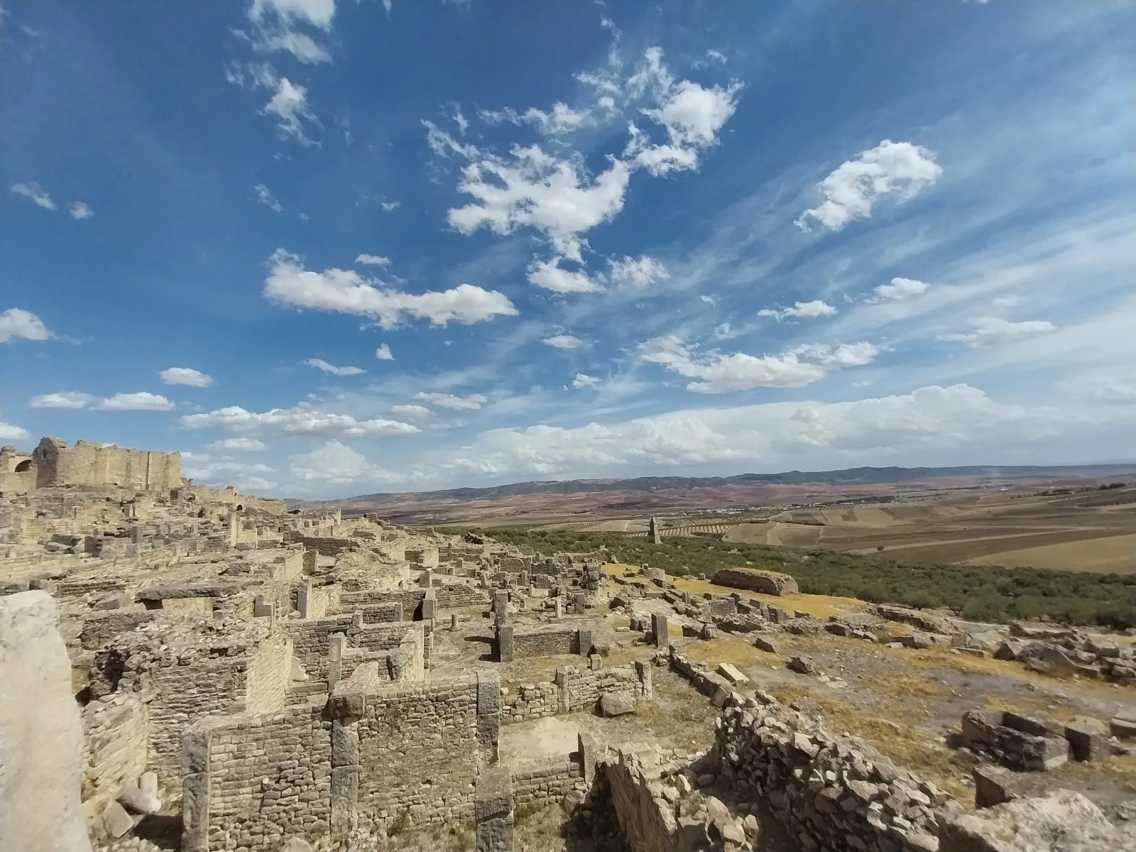
Dougga / Thugga, photographed 30 August 2023. Photograph: Ranya420 / Wikimedia Commons, CC BY-SA 4.0. Recompressed without resizing or cropping; this image version remains under CC BY-SA 4.0. General archaeological landscape, not identification of a particular building phase or a present-condition record. No endorsement implied.

Roman monuments did not begin with an empty town
Dougga, ancient Thugga in Tunisia, was inhabited before Roman annexation. UNESCO describes Roman monuments inserted into a largely Numidian urban fabric. The AOROC research programme adds an important limit: the earlier town remains poorly known, with domestic remains attested only in particular places. An older foundation does not supply a complete recovered plan.
The Open University account places the Capitol across the end of the forum, connected to it by two flights of steps, rather than facing it in the more usual relationship it describes elsewhere. The market and the square beside it add adjoining public ground. ICOMOS describes the small rectangular forum enclosed by a colonnade and later crossed by fortifications, with the Capitol on one side. The square's enclosing edges, the temple front and the later crossing wall were different boundaries within the same central setting.
AOROC describes new neighbourhoods extending into the earlier town's peripheral ground, followed by further residential expansion in other directions. It distinguishes the built town from surrounding burial grounds, reservoirs and other outlying structures. The settlement and its neighbouring ground therefore had related but different extents, which changed over time. AOROC places two imperial arches at the south-western and western limits of the later built area, while relating its northern and eastern edges to the natural topography. Monumental markers and the shape of the ground defined different sides of that extent, rather than forming a repeated perimeter.
For much of the early imperial period, two legally distinct communities occupied the town: a civic community descended from the earlier population and a body of Roman citizens attached to Carthage. The Latin terms are civitas and pagus. Those affiliations do not by themselves identify the ethnicity, citizenship history or address of every inhabitant. Nor does coexistence establish equal power.
Different public domains were not two complete residential maps
Aounallah and Maurin's 2013 chapter gives the forum and market a more specific history. Reading the inscriptions, they argue that the Roman citizens' community controlled the former Numidian public centre, which became the forum, and the market built nearby. In their interpretation, Roman incorporation appropriated existing political and economic ground rather than simply placing an independent new quarter beside it. The argument concerns public space, not every dwelling around the centre.
The same chapter describes enlargement of the Mercury complex beside the market. Completing its ground required a parcel belonging to the other civic community, which relinquished that land. An addition to a monumental group therefore crossed a public-domain boundary: the adjoining ground was not all available under one unchanged authority. The reported financial arrangement does not give a surveyed outline or dimensions for the transferred parcel.
Aounallah and Maurin identify dedications naming the civic community alone at several sanctuaries, and place its public domain around the area assigned to the Roman citizens' community.
Khanoussi's introduction to the excavation report rejects the older model of two separate towns, each community confined to its own quarter. Aounallah and Maurin in turn reject both that neat separation and an account in which everything was common. They find differentiated public domains but acknowledge that private residential boundaries cannot be securely drawn. Shared urban life is not proof that all ground had the same status.
Public works joined different parts of the same town
The western public works add another scale to that distinction. Aounallah and Maurin relate the Aïn el-Hammam aqueduct to its cisterns and a monumental fountain, or nymphaeum, associated with the civic community. Their description places the fountain on the large curve of a street linking the forum area with the lower town.
They distinguish that group from the Aïn Mizeb cisterns farther north-west, which they associate with the forum and market domain. But the authors explicitly say archaeology has not established the exact course from Aïn Mizeb. These exterior relationships do not provide a reconstructed water route, a supply calculation or a map of who could drink where.
The chapter also follows the market portico, Mercury temple and adjoining square as a connected monumental group.
These projects do not establish a smooth progression towards universal equality. Aounallah and Maurin interpret negotiations over public ground and later joint dedications within a changing political relationship. The eventual union of the two communities in 205 does not date the whole town's physical transformation.
Earlier walls shaped later replacement in a southern quarter
The German-Tunisian excavations south of the Maison du Trifolium examined a much smaller area. Beneath a later complex, the researchers found a pre-Roman courtyard building with rooms on its southern side and a substantial eastern wall. Another early wall lay beneath the later street to the north.
The northern courtyard wall survived as foundations because its upper part had been demolished for the street above. The report's photograph and phase plan distinguish that earlier wall from the later paving. An edge of one property could become buried beneath a subsequent circulation space. That is a specific sequence in the excavated quarter, not evidence that every street followed or erased an earlier wall.
Change was not immediate or uniform after annexation. The report describes limited alterations to the courtyard before a larger replacement towards the end of the first century. The later building extended eastwards but retained the broad eastern wall of its predecessor, using it to divide the new complex. Demolition and reuse thus belonged to the same rebuilding: a new outer extent did not require removal of every earlier boundary. The report distinguishes the new complex's north front from its stronger eastern boundary. Upright stone members appeared fully on the outside of the north wall but did not run through its entire thickness; the more regular outer masonry emphasised that face. The eastern boundary was built in successive sections towards the south. The enclosure therefore had differently constructed sides, while the older retained wall organised the division within its expanded outline. The report records the north wall as at least 14.40 metres long and about 80 centimetres thick, while the eastern wall reached up to 1.20 metres. Only these northern and eastern exterior sides had been uncovered. Their alignment followed the retained older wall between the two units, so the new external shell and the inherited dividing line remained related. On the published phase plan, the later street runs between this southern building ground and the northern house frontage. The excavated strips expose parts of that relationship rather than all four sides of a complete freestanding building.
A paved street was constructed to the north at about the same time as that larger replacement. The new paving, the retained wall and the altered building footprint changed the relationship between property and circulation together. Yet the authors distinguish this sector's sequence from the more familiar later monumental expansion. One excavated building cannot give the whole town a single rebuilding date.
Expansion narrowed a street without ending its use
Later changes affected the two sides of the street differently. South of it, substantial rubble covered the earlier structures; north of it, construction associated with the Maison du Trifolium produced separate street-facing units. The report interprets those units as probable shops or small workshops. It does not establish where all the southern rubble originated or exactly how the covered plot was then used.
In the third century, a new wall along the street closed those formerly open units into an annex of the larger house. The addition occupied the earlier open frontage and narrowed the street beside it. The report records continued wheel abrasion against the new walls, indicating that passage continued after the alteration. Enlargement of neighbouring premises and continued circulation were therefore competing uses of the same limited ground.
The authors regard the street as probably public and interpret this narrowing within a prosperous period, rather than as an automatic sign of decay. The physical change was an altered edge and reduced open space, not the immediate disappearance of the connection. The property affiliation of the annex and the legal title of the street are different questions; the report does not supply a complete ownership record.
A later sequence should not be folded into that earlier expansion. The excavators describe removal of paving in part of the street, accumulating deposits and a remaining footpath whose rising level required adjustment at the annex exit. An initially narrowed paved street and a later reduced path were different arrangements. The report warns that this quarter's later history cannot by itself establish the condition of the entire town. The report locates the removed paving in the eastern section and surviving paving beneath later deposits in the western section. The change was therefore uneven along the connection, not one identical surface replaced everywhere at once. Accumulation raised the ground between the two walls, while the annex exit acquired up to three steps in its latest recorded arrangement. A raised path and an adjusted doorway replaced the earlier relationship between a paved surface and the building edge. The annex continued in use after the pavement outside had ceased serving its earlier role, leaving adjoining spaces with different material histories.
The visible ruins preserve an uneven history
The general site plan places the excavated sector south of the central forum group, beside rather than inside the Maison du Trifolium. The detailed phase plan separates earlier walls, the later building and street, and the annex extension.
The centre likewise needs more than one time layer. The Open University account describes the later fortress occupying the forum area and reusing material from earlier public buildings. AOROC relates reuse of monuments to a changed urban organisation and a smaller settlement. These accounts distinguish an inherited public centre, later enclosure and reused fabric, rather than one untouched Roman composition.
Connect the public centre and its differentiated domains with the adjoining parcel, the changing southern building footprints and the street narrowed by an annex. Public affiliation, physical access and residential identity did not coincide automatically. The older town was neither wholly replaced at annexation nor preserved unchanged beneath a Roman appearance. This is a historical explanation of published evidence, not a present property, visitor-access or condition assessment.
Sources
- S1: UNESCO, Dougga / Thugga
- S2: ICOMOS, September 1997 evaluation
- S3: AOROC/INP, Thugga / Dougga research programme
- S4: Khanoussi, Ritter and von Rummel, excavation report, pp 43-66
- S5: Aounallah and Maurin, 2013, public domains and territorial limits
- S6: Open University, Thugga, section 1 video transcripts
- Ranya420, original photograph, Dougga / Thugga
- Photograph and image version: CC BY-SA 4.0
Questions people ask at the gate
Were Dougga's Roman buildings placed on an empty site?
No. UNESCO describes an inherited town, while AOROC stresses that its earlier domestic fabric remains only partly known. New monuments and neighbourhoods did not all replace or preserve earlier ground in the same way.
Did two legal communities mean two separate residential towns?
That is not established. Khanoussi rejects a neat divided-town model; Aounallah and Maurin distinguish public domains while also rejecting an everything-common interpretation. They acknowledge the lack of secure private residential boundaries.
What does the Mercury parcel show?
Aounallah and Maurin describe ground relinquished by one civic community to complete a monumental group associated with the other. Their interpretation concerns a public-space transaction, not a surveyed map of surrounding households.
Can the waterworks identify who had access to water?
Not from this account. The chapter discusses different public affiliations and exterior positions, but says the exact Aïn Mizeb course is unestablished. No hydraulic reconstruction, supply fairness or individual access is verified.
Did narrowing the street immediately end passage?
No. The excavation report records continued use after the annex narrowed it. It distinguishes that change during prosperity from later paving removal, accumulating deposits and reduction to a footpath.
Do the ruins reconstruct the complete ancient town and its people?
No. Earlier remains, later losses, selected excavations and reconstruction have different histories. Public inscriptions and building relationships cannot identify every household or prove equal power, uninterrupted occupation or present conditions.
Next walk starts at a new gate.
Was this helpful?
one tap, no sign-up

A Miranda House graduate and lawyer who traded courtrooms for slow travel. Cheshta travels with the batches we host ourselves, with a soft spot for travelling alongside elders.