




Checked 19 November 2026. Complete returned UNESCO and Parks district accounts read. Nomination chapter2 read selectively at printed pp12-18,19-22,47-49,55-58,65-66, not the whole chapter. McNabb's complete returned chapter pp151-160 and notes and Campbell's complete returned2016 article and notes read; McNabb original PDF passages checked for locators; Campbell read as returned text, not the original PDF. No underlying deeds, maps or datasets inspected. Gagné's complete original PDF body and notes read through conclusion, not figure images. ICOMOS return ends within conservation inventories; not a complete original evaluation. Parks2023 plan read through significance only. Both Mi'kmawey Debert pages read completely as returned. Related heritage accounts share research. No original plans, archival records, interviews, field conditions or current title independently inspected. Conflicting historical representations remain attributed; no current farming, ecological or reconciliation outcome established.
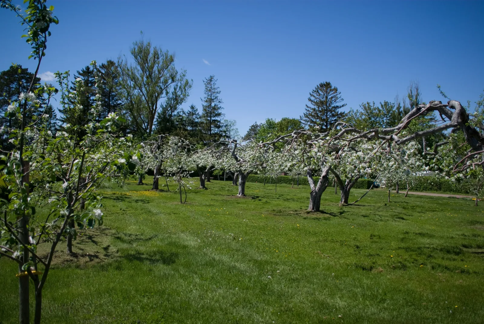
Orchard, Grand-Pré, Nova Scotia. Photograph: CP Hoffman (Charles Paul Hoffman), Wikimedia Commons, CC BY-SA 2.0. Recompressed without resizing or cropping; this image version remains under CC BY-SA 2.0. Orchard illustration, not dyked fields, a historical reconstruction or a present-condition record. No endorsement implied.
CP Hoffman, original Orchard, Grand-Pré photograph · CC BY-SA 2.0, photograph and this image version

Low fields and upland homes formed a connected landscape
Grand-Pré's agricultural landscape joined different kinds of ground. The World Heritage nomination describes reclaimed low fields beside homes, farm buildings and other land on the adjoining uplands. Cultivation and residence were connected without occupying the same surface. The open agricultural ground was not an empty interval between the houses.
The nomination describes long, narrow property forms extending uphill from the edge of the reclaimed land. It interprets these through historical mapping as traces of the earlier French settlement arrangement. These upland strips differed from the irregular fields below. A single landscape could therefore contain several forms of division, rather than one repeated rectangular plan. The original maps have not been independently inspected here.
The relationship also extended beyond an individual house and its nearest field. McNabb's history of Horton Township describes holdings containing different kinds of land in separate places. The dwelling, cultivated ground and woodland did not necessarily make one compact property. Understanding the settlement requires those separated pieces as well as the pattern of roofs. Her study concerns the township, not a reconstruction of every Grand-Pré parcel.
The nomination also distinguishes the settlement's pattern from the buildings within it. Its description places dwellings and farm buildings of several architectural periods across the upland hills, rather than identifying one continuous row of identical houses. The dispersed relationship with agricultural ground could remain recognisable while individual premises were replaced or enlarged. Reading the spaces between buildings therefore answers a different question from dating a roof or front. Neither the settlement pattern nor a familiar house form proves that the same household remained.
The nomination's field description adds a distinction between the agricultural surface and the ownership unit. It records irregular field shapes and properties that could contain more than one field. Boundaries were not generally expressed as continuous hedges or walls; ditches could follow property edges. A broad open expanse could therefore contain separate holdings without displaying an enclosure around each one. This is evidence about the landscape described in the nomination, not a survey of current boundaries or an explanation of drainage operation.
This was not land without an earlier people or history. Parks Canada's management plan places Grand-Pré on unceded traditional Mi'kmaw territory and identifies enduring occupation and the Gaspereau River's importance within a wider cultural landscape. Mi'kmawey Debert Cultural Centre likewise explains territorial relationships that do not reduce to fixed European property lines. A history of settler fields must remain within that longer relationship with place.
Expulsion changed occupation without erasing the productive ground
British forces began the Acadian deportations in 1755. Parks Canada's account records the burning of homes and barns and the subsequent granting of land to New England settlers. The survival of agricultural ground therefore cannot stand for uninterrupted residence by the people who had worked it. Removal and replacement belong within the landscape's history, not outside an otherwise continuous farming scene.
The nomination describes the later settlement plan at Horton beside the Gaspereau River. A compact town plot on higher ground was associated with allotments of cleared upland, reclaimed agricultural land and woodland. These were different components of a grant, not four adjoining parts of a single farm. The proposed residential centre and the productive holdings beyond it answered different spatial needs.
Hortonville's retained town lines supply evidence of that planned arrangement. The nomination identifies a rectilinear framework while also recording a road that bends with the land and partial survival of other streets. A legible grid is not proof that every projected road or town block remained complete. Nor does a surviving street line establish that the surrounding houses all date from the settlement's beginning.
The earlier upland strips and the later town plot thus belong to the same larger agricultural setting without having the same origin. One cannot explain every boundary by the British survey, or treat all visible divisions as untouched Acadian work. Historical settlement, later allotment and subsequent occupation left overlapping rather than interchangeable evidence.
The road relationships add another scale. The nomination describes the Old French Road running parallel to the agricultural low ground, with other lines linking the uplands and fields. It also places the later railway along the southern side of the lowland setting. These were not all the same kind of connection: a road alongside settlement, a line across agricultural ground and the railway related different parts of the landscape. Their alignments help explain how the fields belonged to a larger inhabited territory, not an isolated green surface. No present route or service follows from that historical description.
Scattered holdings helped move residence away from the town plot
McNabb reconstructs the township's initial land divisions through registered deeds and other records. Grants included scattered lots, and the size of a grant varied. Her account connects the survey with holdings spread across different parts of Horton. The compact residential plan did not give every household one continuous block of productive ground immediately behind its home.
Trading did not simply turn that dispersed arrangement into compact farms. McNabb finds frequent sales and purchases, unequal accumulation and continued fragmentation. Some people sold land to obtain money; others increased their holdings. A changed owner did not necessarily mean a changed field boundary, and acquiring more land did not necessarily bring all of it together. The deeds themselves are an incomplete record.
The settlement pattern changed within that property arrangement. McNabb describes inhabitants building on upland lots, closer to the ground they retained or wished to use. Movement away from the town plot placed homes at greater distances from one another, sometimes separated by the holdings of absent proprietors. Fields, ownership and residence were therefore related, but their boundaries did not move in step.
Her account of blacksmith Simeon Dewolf makes this movement particular rather than universal. His home and working premises shifted from the town plot to an upland holding and later farther west. McNabb calls the broader residential evidence impressionistic. The example shows how a planned centre could lose households to dispersed premises; it does not establish one sequence or motive for every settler.
Dewolf's first town premises included a dwelling, barn, smithy and other buildings. McNabb then places his later frame house on upland beside one of his farm lots, with the forge moved there too. Residence and craft work moved together rather than the dwelling leaving an unchanged workshop behind. The new premises also lay beside a travelled road. The relationship was therefore among home, workplace, farm ground and circulation, not simply a choice between the centre and an isolated house. McNabb presents greater accessibility there as a possibility, not a proven motive.
Retained land use did not make agriculture unchanged
The nomination places the dispersed settlement beside the reclaimed fields, with farm buildings, other cultivated ground and woodland on the higher land. That arrangement could persist while particular properties, buildings and agricultural uses changed. A relationship between two kinds of ground is a different kind of continuity from an unaltered boundary or an uninterrupted household history.
Claire Campbell's environmental history draws attention to what a direct line from Acadian farming to later stewardship can leave out. Her account places Grand-Pré within the wider Annapolis Valley and its subsequent commercial agriculture, scientific institutions and transport networks. These are regional relationships, not a new survey establishing what happened on every field within the World Heritage property.
Campbell also connects the railway's agricultural and tourist roles. The same broader economy could move produce while presenting the valley as a pastoral landscape. Fields and orchards were working ground and a selected image. Her argument is not that the image was wholly invented, but that its emphasis could obscure the intervening history that helped shape the landscape.
The heritage accounts and this critique should remain distinct. The 2012 ICOMOS evaluation strongly emphasises agricultural continuity and describes avoidance of industrial transformation; Campbell questions a continuity narrative at the wider valley scale. Neither supports an unqualified claim that every Grand-Pré farm was unchanged, industrialised or sustainable. Selected spatial continuities do not settle the whole history of agricultural practice.
The memorial park made a different kind of ground
The later memorial landscape did not simply preserve the agricultural settlement without alteration. The nomination describes a deliberately composed park around memorial structures on ground associated with the earlier Acadian village. Planted areas, paths and monuments made a distinct setting within the surrounding farmed landscape. Remembrance acquired a physical arrangement rather than only a commemorative name.
Michael Gagné's design history explains how that distinction was made. A planted background and bounded garden directed attention towards the Memorial Church. Paths, trees and the position of individual monuments related separate objects to a central composition. The surrounding agricultural land supplied a larger setting, while the park narrowed attention within it. This is the historian's reading of design records, not our measurement of the original plan.
Gagné describes low hedges and fences defining the garden, existing willows and planted poplars forming a background, and pathways beside a water garden. One path related the Evangeline statue to the composition; another included the stone cross and well. Trees along the paths narrowed attention towards the central building. Enclosure, planting and movement thus organised how individual memorials belonged together, rather than leaving each object in an undifferentiated field. The garden's bounded arrangement also made the cultivated park distinct from the more extensive farmland outside it.
The building itself was a later memorial, not an exact reconstruction of the parish church lost after the deportation. Gagné describes the absence of original plans and the use of later architectural references. The nomination places it on or near the presumed earlier church location. A monument could identify an ancestral place without reproducing its former building or residential life.
The composition also included Evangeline, a fictional character from Longfellow's poem. Her statue and the memorial building became related features in the park's presentation. Literary representation and historical loss were brought into one landscape, but the fictional heroine is not a witness to the deportation. A symbolic figure cannot supply the testimony of a former household.
Symbolic return did not restore an earlier resident community
Gagné distinguishes the dispersed Acadian community associated with the memorial from the local community living around it. The park's boundaries made that distinction physical as well as symbolic: a commemorative setting stood amid agricultural properties with their own later histories. The same wider landscape could be an ancestral homeland for one community and the place of everyday residence for another.
That relationship did not produce one agreed interpretation. The nomination describes reconciliation and calls Grand-Pré an uncontested landscape. Gagné documents competing Acadian, local anglophone, railway and national narratives, including objections during the nomination period. Specific cooperation and specific disagreement need not cancel each other. Neither dated account establishes unanimous harmony or conflict today.
The settler succession is also not the whole territorial story. Mi'kmawey Debert describes Planter and other British migration as contributing to Mi'kmaw displacement, while explaining that the Peace and Friendship Treaties did not cede territory. This provides historical context, not a present legal opinion about a named farm. Acadian loss must not make continuing Indigenous relationships disappear.
Our suggestion is to connect the low fields and upland settlement, the redistributed and traded holdings, and the later park's selected memorial ground. Productive use, property, residence and remembrance followed different histories in the same place. A symbolic return could make absence visible without undoing expulsion, restoring the former households or returning every field to an earlier arrangement. This is historical landscape interpretation, not a current property, access, ecological or visitor assessment.
Sources
- S1: UNESCO, Landscape of Grand Pré
- S2: Nomination chapter2, selected landscape, settlement and memorial passages
- S3: Debra McNabb, Horton Township, pp151-160
- S4: Claire Campbell, Idyll and Industry,2016
- S5: Michael Gagné, Memorial Constructions,2013
- S6: ICOMOS2012 evaluation, bounded return
- S7: Parks Canada2023 management plan, significance section
- S8: Mi'kmawey Debert, treaty-making
- S9: Mi'kmawey Debert, Mi'kma'kik
Questions people ask at the gate
Why connect the low fields with the upland settlement?
The nomination describes agricultural ground below and homes, farm premises and other land above. These connected spaces had different roles. The fields were not empty scenery between isolated buildings.
Did continued farming mean the same community remained?
No. British deportation removed Acadians, and land was subsequently granted to New England settlers. Continued productive use cannot stand for uninterrupted residence or unchanged ownership.
Did trading turn every scattered grant into a compact farm?
No. McNabb describes trading and unequal accumulation alongside continued dispersed holdings. Her Horton Township evidence is incomplete and cannot reconstruct every Grand-Pré parcel or household.
Was the Memorial Church an exact replacement of the earlier church?
No exact reconstruction is established. Gagné describes later design references and missing original plans; the nomination says on or near the presumed earlier location. A memorial is not the recovered original building.
Do the sources agree that the landscape was uncontested and agriculture unchanged?
No. The nomination's reconciliation framing differs from Gagné's documented disagreements. ICOMOS's strong continuity emphasis differs in scale and purpose from Campbell's regional agricultural critique. Neither disagreement establishes today's conditions.
Does symbolic return establish property rights or restore the former community?
No. Memorial association, residential occupation and title are different matters. Continuing Mi'kmaw territorial relationships also remain part of the history. No current legal title, visitor entry or access right is established here.
Next walk starts at a new gate.
Was this helpful?
one tap, no sign-up

A Miranda House graduate and lawyer who traded courtrooms for slow travel. Cheshta travels with the batches we host ourselves, with a soft spot for travelling alongside elders.