



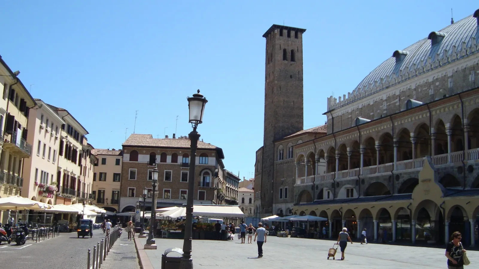

Martin Stiburek (Pimlico27), "Padova 6975", July 2012, via Wikimedia Commons, CC BY-SA 4.0. Cropped and resized by The Trip Keeper; this adaptation is shared under CC BY-SA 4.0. Historical illustration, not present conditions or a route. No endorsement implied.
Martin Stiburek · Wikimedia Commons · CC BY-SA 4.0

Reviewed 19 November 2026. Historical interpretation using Treccani's complete Storia e urbanistica section, not the whole art entry; Zaggia's complete article and notes; the supplied complete ARMEP introduction and contents, not its volume chapters; Giacomello's Rudena synthesis, printed pp.154-159, and conclusions, pp.161-162, not the whole thesis; the civic library's complete collection page; the complete 1927 planning text and editorial introduction; and two related university histories. These sources share earlier research and are not independent whole-city surveys. No original archive, research map, collection photograph, building or present condition was inspected. Ancient hydrological continuity remains unresolved; cadastral dimensions and later alignments do not directly establish house dates or initiating causes.
The university's changing premises lead into a larger city
Padua's medieval university had a dispersed physical presence. In his architectural-history paper, Stefano Zaggia describes medieval teaching, meetings and lodging in premises borrowed or shared with other institutions. These buildings were often multifunctional and did not necessarily announce themselves as a separate kind of architecture. The institution belonged within an occupied city before it acquired a more recognisable central building.
The later Bo complex did not replace that city with a new precinct. Zaggia places the leased hospitium bovis at a junction connecting market squares and public offices with productive areas. Subsequent purchases and staged rebuilding brought earlier structures into a larger academic complex. Concentration happened through property and building decisions within existing urban relationships.
That is a useful starting point, rather than a complete explanation of Padua. The civic-market setting differed from the episcopal area. Eastern boroughs developed differently from western ground, while houses and religious properties formed smaller relationships within them. Later university buildings and central clearance changed those connections again. The teaching institution was one participant in this larger formation, not its single author.
The channels belong to the same question, but not as an unchanged diagram. Federico Giacomello's study of Borgo Rudena leaves the persistence of ancient hydrology among the unresolved problems of Padua's urban history. An account of buildings and settlement need not pretend that every later watercourse reproduces an ancient line.
Inherited routes and outward settlement did not form one regular pattern
M. Merotto Ghedini's signed medieval-city account rejects the earlier model of a regular Roman street grid for Padua. It instead discusses continuities in important road lines across different periods. Inherited connections and a neatly repeated set of rectangular blocks are not the same claim. Nor does either one establish the age of every house beside a street.
The early built city is less securely recoverable than a simple growth diagram suggests. Merotto Ghedini distinguishes limited evidence from competing explanations of late-antique and early-medieval change. Cultivated ground and more closely built areas later coexisted. A familiar account of destruction followed by rebirth should not become a complete map of where everyone lived.
Outward development was uneven too. The same account identifies stronger eastern expansion through bridge-related settlements and more limited western growth. It specifically distinguishes San Benedetto's foundation in sparsely occupied western ground from an already formed borough. A religious establishment outside the centre did not always enter the same kind of neighbourhood.
Later enclosures brought differently developed areas into a larger city. Their shared boundary did not give their institutions, streets and houses one beginning. The useful relationship is between inherited connections, changing occupation and distinct outward areas, rather than a set of identical rings expanding around an unchanged centre.
Rudena joins religious settings to streets, small plots and houses
Giacomello's synthesis of Borgo Rudena gives the eastern side a more particular history. Drawing together documentary, archaeological and property evidence, he describes several settlement nuclei associated with religious establishments and routes towards the earlier city. Rudena was not simply one completed neighbourhood placed outside a gate. Its parts developed through different connections.
The later presence of the Basilica of Sant'Antonio changed the reference points of the southern area. Giacomello relates subsequent street and plot orientations to the large religious building. He also expressly stops short of securely establishing that the basilica initiated the area's urbanisation. A later alignment towards a building is firmer evidence than an assertion that the building caused everything around it.
Residential property keeps that account from becoming a list of churches. The study connects small plots, arcaded rows of houses, religious landholding and textile-related occupations. It compares a later cadastral plan with documents and earlier drawings of properties. Plot dimensions compatible with medieval patterns support an interpretation; they do not directly date every surviving house or establish an untouched medieval neighbourhood.
The earlier ARMEP research introduction makes another limit clear. Its residential survey concentrated largely on street fronts within the communal circuit, with selected closer studies. It did not inspect every interior or all the outer boroughs. Giacomello's later Rudena study extends that research question rather than turning the earlier sample into a complete census.
Institutional growth could also remove housing. Giacomello describes houses acquired and demolished for the San Francesco hospital group. The new institution therefore belongs to the history of residential ground as well as to the history of care. Its construction alone does not establish the history or experience of every household associated with that ground.
Civic ground and academic concentration remained different arrangements
Merotto Ghedini places the civic-market group apart from the episcopal setting. Her account relates the later loggias of Palazzo della Ragione to adjoining open spaces and neighbouring public buildings. The building and the spaces beside it formed a connected civic arrangement. This describes the relationship between the building and its urban setting, rather than its interiors or a reconstruction of every earlier building.
Zaggia's account places the developing Bo complex within a different relationship. Rooms in an existing property were leased for teaching, more premises were acquired, and rebuilding brought parts together over time. Some earlier structures were only partly affected. A recognisable university headquarters could result from successive changes rather than one new building constructed on empty ground.
Other needs remained spatially distinct. Botanical teaching acquired its own ground, while the observatory later adapted the Torlonga and adjoining buildings. These were different kinds of institutional intervention: a specialised teaching site and the transformation of an older building group. Bringing teaching into Bo did not mean putting every academic function under one roof.
The proposed library makes the difference between intention and building especially clear. Adjoining private property was purchased for a new library beside Bo, but the scheme was not completed above its ground-floor stores. Part of the intended entrance area later housed experimental-physics instruments. The name of a proposed institution is not evidence that its planned reading spaces were built.
Keep these arrangements beside Rudena's religious property and housing. A civic group connecting neighbouring open spaces, acquired central teaching premises, separate scientific grounds and institutions replacing houses were related parts of Padua, but they did not follow one property process or one construction campaign.
Later projects changed both central ground and the university districts
Padua's later remaking was not simply the completion of its older form. The civic library's collection presentation records demolition in the Santa Lucia area and the formation of Piazza Spalato, later Piazza Insurrezione. Its captions identify different demolition records and later stages of the new setting. They describe a process, not one instant when an entire city changed.
A planning text published in 1927 preserves a contemporary disagreement about that direction. Piccinato and the Gruppo degli Urbanisti Romani proposed connecting changes within the older centre with outward districts, the station and industrial land. Their account criticised central clearance and argued for a different relationship between the centre and the expanding city. It is evidence of a position in a debate, not proof that their alternative was executed or would have delivered its claimed benefits.
The university also continued to alter more than one area. Its building histories describe renewed central premises alongside a developing scientific district around Santa Sofia and the Piovego-related area. Individual institutes were built, enlarged and reorganised in stages. At Chemistry, completion, furnishing and first use were separate events. There was no single moment when the university simply left the centre for a finished outer campus.
An earlier proposal by Giuseppe Jappelli in 1824 likewise remained unbuilt. Zaggia treats it as a proposed reorganisation, not a completed university precinct. It cannot explain the later city as though its drawings had become buildings. The realised histories of subsequent institutes must be kept separate from that intention.
Architectural investment is not a verdict on institutional freedom or inclusion. The university's historical timeline records racial-law exclusions of Jewish staff and students in the same broader period as major building campaigns. Construction and persecution belong to different kinds of historical evidence; the first cannot cancel the second.
Read the relationships without filling the gaps
Padua becomes clearer when its different institutional geographies remain connected. Civic-market buildings and episcopal ground were not one centre. Academic activity could become more concentrated while separate facilities persisted. Religious establishments belonged to differently developed boroughs, where houses, plots and productive occupations also mattered. Later clearance and scientific construction changed both the centre and the wider city.
The records require the same distinctions. A later cadastre can help test older plot arrangements without directly dating every wall. A building's orientation can be a reference for subsequent growth without proving an initiating cause. A plan can reveal an intended urban relationship without recording completed work. A collection caption can identify a historical record without becoming a new inspection of the image or the present site.
Our suggestion is to keep that whole in view. The channels are part of the settlement setting and its later changes, not a shortcut to an exact ancient plan. The university is part of the city's property and institutional history, not a separate finished campus that explains everything around it. Neither one religious building nor one cleared square replaces the relationships among them.
This interpretation uses published research and institutional histories. It does not reconstruct every property, early boundary or channel, and it is not a new survey of original plans, buildings or present conditions. It supplies no current route, entry, operation, property right, hydraulic mechanism, structural assessment or safety promise.
Sources
- Treccani, complete Storia e urbanistica only, not entire art entry; checked 19 Nov 2026
- Zaggia, complete architectural-history article and notes; checked 19 Nov 2026
- ARMEP, complete supplied introduction and contents, not volume chapters; checked 19 Nov 2026
- Giacomello, Rudena synthesis pp.154-159 and conclusions pp.161-162 only; checked 19 Nov 2026
- Padua civic library, complete Piazza Insurrezione collection page and captions; checked 19 Nov 2026
- Piccinato and Gruppo Urbanisti Romani, complete 1927 text and editorial introduction, proposal not execution; checked 19 Nov 2026
- University of Padua, complete twentieth-century building catalogue, disputed Engineering dates omitted; checked 19 Nov 2026
- University heritage timeline, complete twentieth-century account, related institutional source; checked 19 Nov 2026
Questions people ask at the gate
Did Padua inherit one regular Roman grid?
Merotto Ghedini's account rejects that simple model while discussing continuity in important road lines. Inherited routes do not prove regular rectangular blocks or unchanged buildings. The early settlement picture remains incomplete.
Did the university become one separate campus at Bo?
No. Zaggia describes dispersed multifunctional premises, later concentration through leased and acquired property at Bo, and separate facilities for other teaching and research needs. A central headquarters did not put every function in one place.
Did Sant'Antonio cause Rudena to grow?
Giacomello relates subsequent streets and plots to the basilica's orientation but does not securely establish that it initiated urbanisation. The study supports a relationship with later development, not a single-cause explanation for the whole borough.
Can the cadastral plots date the surviving houses?
Not directly. Giacomello compares later plots with documents and property drawings. Dimensions compatible with medieval patterns are interpreted evidence, not construction dates for every surviving building. ARMEP's earlier survey also had a limited, largely exterior sample.
Were the proposed library and later planning schemes completed as drawn?
They need separate answers. The Bo library scheme was not completed above its ground-floor stores. Jappelli's 1824 university proposal stayed unbuilt. The 1927 text records a competing planning position, not proof that its alternative was executed.
Do the later science district and cleared square explain one final city plan?
No. The civic collection documents stages of clearance, while university histories describe central rebuilding and institutes constructed and altered over time. Proposals, completed work and later use are different evidence. They do not establish one finished plan or an unchanged historical city.
Next walk starts at a new gate.
Was this helpful?
one tap, no sign-up

A Miranda House graduate and lawyer who traded courtrooms for slow travel. Cheshta travels with the batches we host ourselves, with a soft spot for travelling alongside elders.