



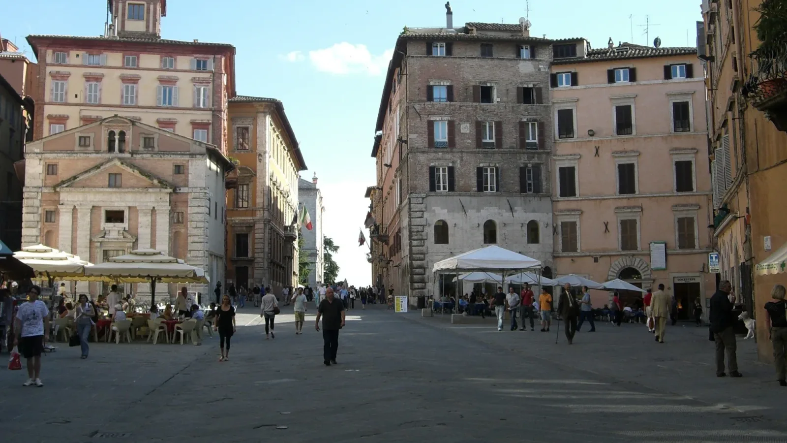

Daniele Costantini, "Perugia, 2009 - Piazza della Repubblica", 30 June 2009, via Wikimedia Commons, CC BY-SA 4.0. Cropped and resized by The Trip Keeper; this adaptation is shared under CC BY-SA 4.0. Historical illustration, not a record of present conditions or a route. No endorsement implied.
Daniele Costantini · Wikimedia Commons · CC BY-SA 4.0

Reviewed 19 November 2026. Historical interpretation using the complete early-medieval Treccani section signed P. Castellani and the later opening and architecture subsection, not the whole art entry; Bistoni Colangeli and Monacchia's complete 1995 essay, notes and appendix recovered from the original PDF; the complete Siena-hosted synthesis and museum building history; two related Baldeschi accounts; the complete provincial landing history and selected chapters 1 and 4, not the whole publication; and the complete court and Touring records. These seven related source families share earlier scholarship, not seven independent whole-city reconstructions. Early cathedral location/orientation, civic-building chronology, Sopramuro dates and window-surround dating remain qualified. No original archive, research figure, plan, building or present condition was inspected.
The gate names connect two different geographies
Perugia's historical form extends beyond its hilltop centre. The medieval-city account in Treccani describes boroughs growing outside the older enclosure, along routes associated with five principal gates. Development followed ridges and valleys, producing the radiating form identified in that account. The later enclosure brought outward settlement into a larger city.
The same gate names also belonged to a different geography. In their study of Perugia's medieval cadastral records, Maria Grazia Bistoni Colangeli and Paola Monacchia explain that the administrative sectors called porte extended from the main square to the boundaries of the surrounding territory. Each included urban parishes and rural settlements. A gate sector was therefore larger than a continuously built borough.
Keep those two meanings together without confusing them. A physical gate, the settlement outside it, an administrative sector and the later city boundary were related, but they were not four names for the same area. Nor does the familiar five-part description establish five equally built fingers or five identical histories.
This distinction gives a useful starting point for understanding the city. Follow how outward settlement related to institutions, then connect those areas with changing civic and market premises, residential property and later rebuilding on the hill. Perugia was neither only the old enclosed centre nor a diagram completed once and left unchanged.
Religious institutions belonged to different stages of outward settlement
The early-medieval section of Treccani's account, signed by P. Castellani, places San Pietro beyond the southern side of the older enclosure and Sant'Angelo beyond the northern side. It relates later borough growth to the ground between these religious sites, the corresponding gates and routes leading towards the city. Institutions outside the earlier limit were part of the setting in which subsequent settlement developed.
That does not mean every church outside a gate began a borough in the same way. The later architectural history identifies different locations and building histories: the Dominicans in the Porta San Pietro area, the Augustinians in Borgo Sant'Angelo and the Franciscans at San Francesco al Prato in the Porta Santa Susanna area. Parishes, confraternities, hospitals, workshops and housing also formed parts of the expanding city.
Those differences matter more than arranging religious buildings in a list. Earlier external foundations and later convents did not share one starting date or the same relationship to settled ground. A larger enclosure eventually connected areas whose institutions and buildings had developed through different processes. The boundary did not create all the settlement inside it.
The early history also contains unresolved questions. Castellani discusses competing identifications of the first cathedral and different interpretations of an earlier cathedral's orientation. Neither uncertainty needs a new answer to explain the broader relationship between inherited ground, external institutions and later expansion. Keep the supported connection without turning it into an exact reconstruction of the whole early city.
Civic property and the market edge changed in different ways
The cathedral-area civic premises and Palazzo dei Priori should not be compressed into one public building. The historical accounts distinguish an earlier residence for civic magistrates near the cathedral from the developing complex across the principal square. They connect the latter with the acquisition and incorporation of neighbouring property, including houses, a tower-house and church ground. Civic building involved changes to an occupied area.
The Priori complex then expanded and was altered again. Its building history records attempts to coordinate parts of different origins, followed by changes to openings, stairs and the upper profile, and later reconstruction. The coherent appearance of a public building is not a complete chronology of the property behind its fronts. This is a building-formation relationship, rather than an account of its rooms or collections.
The Sopramuro, now Piazza Matteotti, adds another kind of institutional ground. Touring Club Italiano describes a market and service setting, while the court's building history connects its edge with premises funded by the hospital of Santa Maria della Misericordia. A row of shops was followed by construction above them, later university occupation and, subsequently, judicial use. Commerce and institutions were related through buildings that changed purpose.
That history is more specific than calling both spaces civic squares. Around the principal square, public institutions acquired and incorporated older property. At the Sopramuro edge, shop premises and construction above them helped form a different institutional arrangement. Later removal of the fish market for a postal building changed that setting again. These were connected parts of Perugia, not interchangeable open spaces between monuments.
A unified residential front could contain several dwellings
Residential property supplies a different scale of change within the city. The foundation's history of Palazzo Baldeschi al Corso describes an earlier residential nucleus enlarged through additions of neighbouring houses. Later work brought heterogeneous buildings into a more coordinated architectural body facing Corso Vannucci. The municipal description likewise identifies the palace as the result of joining earlier buildings.
The distinction is not simply between an old house and a new palace. The foundation describes a large structure that remained divided into several dwelling units. A common entrance and more unified exterior did not necessarily turn every part into one undivided household. Property assembly, architectural presentation and domestic subdivision are separate questions within the same history.
Some details remain less certain. The proposed date for the common window surrounds is explicitly described as probable without documentary support. Their visual consistency cannot supply a certain date for every earlier building or wall. Baldeschi is also a prominent residential example, not a standard type representing all Perugian homes.
The cadastral study explains why a broader residential picture requires care. Descriptions of owner-occupied houses became less visible in later fiscal records when those houses did not produce taxable rental income. Their disappearance from a description is not proof that the buildings disappeared. Conversely, copied property descriptions could retain old information long after circumstances changed. Written continuity and physical continuity must be tested separately.
Rebuilding Colle Landone reopened the question of where the city should grow
Later rebuilding did not merely add another historical-looking front. The Province of Perugia's history places its nineteenth-century palace within the wider remaking of Colle Landone after removal of earlier works. It describes years of proposals and disagreement over the area's future. Some favoured investment in the historic hill; others preferred attention to expansion on the plain below. The hilltop's continued importance was a choice under discussion, not an inevitable result of its earlier prominence.
A reproduced municipal programme from 1863 makes the relationships more concrete. It called for the extension of streets and the arrangement of open ground around a central building funded by the municipality. Lateral buildings were envisaged as private undertakings, including dwellings and other premises. Public and private building were meant to contribute differently to a larger urban project.
Those were programme terms, not a description of everything eventually completed. The history records repeated competitions, revised projects and changing intentions for the central building. Its eventual provincial and prefectural purpose differed from an earlier ambition centred on the arts and a museum. A proposal, a built structure and its later institutional use need not coincide.
Read this alongside the older outward settlement rather than as the conclusion of one palace story. Perugia had previously expanded through gate-linked routes and institutions. The later debate concerned how to remake prominent inherited ground while the wider city could develop elsewhere. It connected the hill and the land below through decisions about investment, streets, property and purpose.
Read the built city and its records together, but not as substitutes
Perugia's administrative history helps explain its urban form without supplying a transparent map of it. The cadastral essay follows how declarations, property boundaries and ownership changes were recorded and revised. It also identifies disorder in surviving registers, old descriptions carried forward and accounts that remained nominally open after their effective activity had ceased. These records need interpretation, not a literal reading as a complete survey of occupied ground.
The built examples require the same distinctions. An assembled civic complex could later receive a more coordinated exterior. A residential building could look unified while containing several dwelling units. A market edge could acquire university and judicial uses. A later hilltop programme could propose private buildings beside public premises without every proposal becoming a built outcome. None of those relationships is explained by one date or one architectural label.
Our suggestion is to connect the gate-linked boroughs with the larger territorial sectors, then retain the differences among religious settlement, acquired civic ground, commercial-institutional premises and domestic property. The later Colle Landone debate belongs in that account because it shows that the relationship between the inherited hill and wider development continued to be reconsidered.
This is an interpretation of published historical research and institutional building histories. It does not reconstruct every property, household or early boundary, and it does not establish present operations or physical conditions. The result is a city understood through connected but different processes, rather than a single hilltop monument standing for everything around it.
Sources
- Treccani, 1998, complete Castellani early section and later architecture only; checked 19 Nov 2026
- Bistoni Colangeli and Monacchia, 1995, complete original PDF essay/notes/appendix; checked 19 Nov 2026
- Siena-hosted synthesis, complete page and six source notes, not plans; checked 19 Nov 2026
- National Gallery, complete palace formation history, not visitor claims; checked 19 Nov 2026
- Fondazione Perugia, complete Baldeschi history, window date uncertain; checked 19 Nov 2026
- Municipality, complete Baldeschi record, same related source family; checked 19 Nov 2026
- Province, complete landing history, competing hill/plain investment; checked 19 Nov 2026
- Province, complete selected chapter 1, imagined scenes not adopted; checked 19 Nov 2026
- Province, complete selected chapter 4, programme not completed outcome; checked 19 Nov 2026
- Court, 12 April 2023, complete building history, chronology conflicts omitted; checked 19 Nov 2026
- Touring, complete Sopramuro record, no engineering or current claims; checked 19 Nov 2026
Questions people ask at the gate
Are Perugia's five gate sectors the same as five built boroughs?
No. The boroughs developed along routes associated with the gates, while the administrative porte extended from the main square into the surrounding territory. A sector included urban parishes and rural settlements. The physical gate, outward borough and territorial division are related but different categories.
Did the later enclosure create all the settlement within it?
No. The historical account places religious foundations beyond the earlier enclosure and describes subsequent borough growth and other institutions before completion of the larger boundary. Inclusion connected areas with different beginnings; it did not give every building or settlement one foundation date.
Why connect the Sopramuro's shops with institutions?
The court's building history describes hospital-funded shops, later construction above them, university occupation and subsequent judicial use. That sequence joins commercial premises with changing institutional purposes. It gives the market edge a history different from the acquisition and expansion of the Priori complex.
Did Palazzo Baldeschi's unified appearance mean one single dwelling?
Not according to the foundation's history. It describes earlier buildings progressively combined into a larger structure while several dwelling units remained. Visual coordination, property assembly and the number of dwellings are different questions. The dating of the common window surrounds remains an explicitly qualified inference.
Can the cadastral records show exactly which houses survived?
Not on their own. Owner-occupied houses could be omitted as fiscal recording changed, and older descriptions could be copied after circumstances had altered. A missing entry does not establish demolition; repeated wording does not establish unchanged fabric. The essay explains the records' formation and limits rather than supplying a complete house map.
Why include the nineteenth-century hill-versus-plain debate?
It connects the remaking of Colle Landone with wider choices about urban growth. The provincial history records competing priorities, revised projects and a change from an arts-oriented ambition to provincial and prefectural use. The 1863 programme also distinguished public central building from proposed private lateral premises. Proposal and realised outcome must remain separate.
Next walk starts at a new gate.
Was this helpful?
one tap, no sign-up

A Miranda House graduate and lawyer who traded courtrooms for slow travel. Cheshta travels with the batches we host ourselves, with a soft spot for travelling alongside elders.