



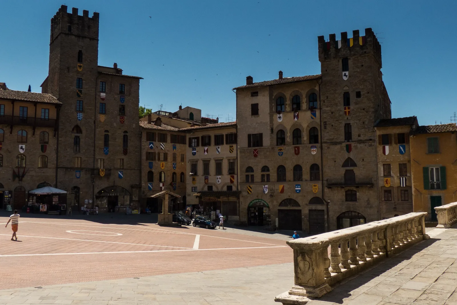

s9-4pr, Arezzo - Piazza Grande, 3 June 2015, via Flickr and Wikimedia Commons, CC BY 2.0. Recompressed, no crop. Historical piazza illustration, not a photograph identifying the medieval housing discussed here or a record of present conditions or access. No endorsement implied.
s9-4pr · Flickr / Wikimedia Commons · CC BY 2.0

Reviewed 19 November 2026. Historical interpretation using Nucciotti and Causarano's introduction, complete Siena and Arezzo subsections and opening Florence discussion, not the full article; Franceschi's episcopal and communal/social sections and later civic-building passage, not the full paper; Fulconis's introduction and sections 2-3, plus opening section 4, not the whole paper; Treccani's signed early urban section and relevant later urban/architectural run through the cathedral sequence, not the full art entry; the municipal planning analysis's introduction and urbanised-areas subsection; the complete historical plan page; and the complete short municipal profile derived from the 1990 guide. These sources share earlier scholarship. Arezzo's residential detail is mediated through the short Nucciotti/Causarano subsection and Mini's unrecovered thesis, not an independently inspected house survey. No original archive, research figure, plan, building or present condition was inspected.
The hill city and Pionta were different starting points
Arezzo's historical geography cannot be explained by one old centre gradually moving downhill. The medieval architectural account and Franco Franceschi's historical study place an important episcopal establishment on the separate hill of Pionta, outside the older city. Cathedral buildings, the bishop's premises and associated religious life belonged to that setting. The older hill city and the bishop's establishment were related without occupying one place.
The pieve supplied another reference. Santa Maria della Pieve and the borough around it had a different relationship to the older city from Pionta's cathedral complex. Maxime Fulconis's study distinguishes the hill civitas from the developing borough below. A cathedral, a baptismal church and an inhabited borough should not be compressed into one religious centre that simply changed its name.
Houses are necessary to this explanation. The city was inhabited beyond its most conspicuous religious and public buildings. Michele Nucciotti and Marie-Ange Causarano's residential study reports smaller building forms alongside towers and palaces, together with municipal provision of small building plots during thirteenth-century expansion. Growth involved places to live as well as places from which institutions exercised authority.
The detailed residential evidence used here comes from that article's Arezzo subsection and depends on Alessio Mini's survey. Mini's thesis itself was not recovered or read for this account, so no direct examination of his survey or drawings is claimed. The evidence can broaden a monument-led picture of expansion; it cannot locate every household, assign a social class to every house or reconstruct all the boroughs.
The pieve borough became part of the city without losing every distinction
The borough's relationship with the city changed over time. Fulconis discusses earlier documents which distinguished built ground near the city from the civitas itself. That distinction concerns how places and people were described in particular records. It is not proof that the borough was empty, unrelated to the hill city or inhabited by one uniform population.
Later evidence shows a different relationship. A document from 1180 locates a palace near the pieve within the city. In an example from the following year, a consul of the borough's society appears alongside civic officers. Incorporation and a particular borough organisation could therefore coexist. One wider urban relationship did not instantly remove every earlier distinction.
The streets help explain why this was more than a change of terminology. Treccani's architectural account identifies the Borgo Maestro, associated with the present Corso Italia, as important to expansion. It connects the pieve and the developing city with a principal route, while the nearby market ground became a communal square. Residential settlement, a religious reference and civic open space belonged to connected but different arrangements.
Those relationships should not become a complete legal or social map. Fulconis offers alternative explanations for an earlier reference to urban and suburban citizens, including a possible discontinuous civitas involving Pionta. Neither explanation is settled here. The firmer point is that the physical settlement, the names used for it and the organisation of its inhabitants did not always have identical limits.
Smaller houses change the scale of the expansion story
A history built only from towers, palaces and churches gives disproportionate weight to the buildings easiest to recognise. Nucciotti and Causarano explain that smaller medieval buildings can be more altered and less visible without necessarily having disappeared altogether. Their Arezzo discussion reports a wider residential repertoire preserved within later fabric. The prominent buildings are evidence, but not a complete census of the inhabited city.
The municipal building plots add a different kind of evidence. The article reports small plots made available in the middle of the thirteenth century and connects them with the role of lower-cost building units in expansion. This was residential provision at a scale different from a major palace. The statement is mediated through the research cited by the article, not a new reading of the original grants.
Put that provision beside the borough's changing position. Bringing more settled ground into the city was not only a matter of connecting churches and civic offices. Space for smaller dwellings also belonged to the expansion. The evidence does not establish that every municipal plot stood in the pieve borough, or that a particular surviving house occupies one of those plots. A broader relationship is supported more firmly than an address-by-address reconstruction.
The study's social interpretation also needs limits. Its smaller types cannot identify the class, occupation or income of every household. Nor do offered building plots prove that all houses were completed immediately. The useful distinction is between the scale and variety of residential building and the much more visible monumental record, not a map dividing Arezzo into rich towers and poor boroughs.
Cathedral functions and civic places changed in stages
The episcopal move into the city was not one completed building event. Franceschi describes pressure towards more continuous residence within the city. The architectural account distinguishes episcopal premises near the pieve from later premises near San Pier Maggiore. A bishop's residence and the church performing cathedral functions were related institutions, but their building histories were not identical.
In 1203, San Pier Maggiore took on cathedral functions. The later Gothic cathedral belonged to a subsequent construction campaign beginning in the later thirteenth century. Keeping those stages separate avoids turning a transfer of functions into the completion date of the present cathedral. It also shows movement towards the hill city, which does not fit a single downhill direction.
Civic places changed within that city too. The historical accounts distinguish the communal square, successive public premises and the Palazzo del Popolo. They relate important construction to altered streets and a connection between public places. The changing civic city was not one palace carried from one location to another, and its buildings did not all appear together on previously unoccupied ground.
Read these changes beside residential expansion. A borough could become more closely incorporated while smaller building provision extended the inhabited city and public institutions altered their premises. That does not prove one coordinated programme behind every house and street. It does prevent either the cathedral's relocation or a public building's date from standing for the whole city's growth.
Later rebuilding did not leave an untouched hill city
The hill-city places themselves did not remain intact after those medieval changes. The architectural history and municipal overview describe the later removal of earlier civic buildings and destruction at Pionta. The familiar historical setting therefore contains losses as well as continuities. An earlier institution's location is not proof that its buildings remain there unchanged.
Residential evidence requires the same care. Treccani discusses altered civil buildings, shortened towers, reconstructed fronts and uncertain identifications. Nucciotti and Causarano's warning about the unequal visibility of smaller buildings is relevant alongside those changes. What is easiest to see or name is not necessarily what best represents the full range of earlier habitation.
The pieve borough, civic places and smaller houses must consequently remain in the same explanation without being given one survival history. A route could retain importance while the buildings beside it changed. Cathedral functions could move before the later cathedral was built. A building type could remain identifiable in altered fabric without preserving a complete household arrangement.
None of this establishes a simple progression from episcopal power to civic freedom, or from political defeat to cultural decline. Franceschi questions such direct equations and stresses the continuing complexity of episcopal and communal relations. Institutional conflict, building investment and the lives of residents are different kinds of evidence. One cannot supply a verdict on all the others.
Expansion below raised another question of connections
Much later development towards the plain did not complete a story in which everything left the hill. The municipality's historical planning analysis describes the railway as a separation as well as a connection between older urban ground and growing southern areas. It also distinguishes residential settings with different forms rather than one uniform new city below. These are observations from that analysis's own period, not a description of present conditions.
The accompanying history of plans records repeated attempts to address those relationships. It distinguishes proposals, delayed or partial work and different approval stages. The 1929 proposal to lower the railway is not evidence that this was done. Later efforts to improve links likewise cannot be treated as a single completed solution simply because they appeared in a plan.
This later evidence returns the question to inhabited ground. New residential areas, older boroughs, civic places and the hill were not interchangeable parts. Earlier growth had involved a pieve borough and smaller building provision alongside institutional changes; later expansion produced other housing and connection questions. The two periods are related in the city's history without sharing one property process or one plan.
Our suggestion is to keep those different movements together: separate Pionta, the pieve borough's changing relation to the city, smaller residential provision, staged episcopal and civic changes, and later expansion with new divisions and links. This interpretation uses bounded published research. It does not reconstruct every house or early boundary, inspect original plans or buildings, or establish present operations, access, property rights, physical condition or safety.
Sources
- Nucciotti/Causarano 2022, introduction and Siena/Arezzo subsections; Mini survey not directly read; checked 19 Nov 2026
- Franceschi 2002, bounded episcopal/social sections and civic-building passage only; checked 19 Nov 2026
- Fulconis 2023, introduction and sections 2-3, opening 4 only; 1203 wording qualified; checked 19 Nov 2026
- Treccani 1991, relevant signed urban and architectural sections only, not full art entry; checked 19 Nov 2026
- Municipal planning analysis, introduction and urbanised areas only, dated observations; checked 19 Nov 2026
- Municipal historical plans, complete page; proposals and execution kept separate; checked 19 Nov 2026
- Municipal profile from 1990 guide, complete short text; evaluative claims not adopted; checked 19 Nov 2026
Questions people ask at the gate
Was Arezzo one centre that gradually moved downhill?
That model is too simple. The episcopal establishment at Pionta was separate from the older hill city, while the pieve borough supplied another reference. Cathedral functions later moved into the city, and residential expansion and later growth below followed different relationships. The movements were not all in one direction.
Was Santa Maria della Pieve the same place as Pionta's cathedral?
No. The sources distinguish the pieve and its borough from the separate episcopal complex at Pionta. Santa Maria della Pieve must also not be confused with Santa Maria in Gradi. Their names do not make these different institutions or locations interchangeable.
Did the borough's incorporation erase its earlier organisation?
The evidence does not support an instantaneous change of that kind. Fulconis places the 1180 city-location formula beside the 1181 appearance of a borough-society consul alongside civic officers. A wider urban relationship and a particular borough organisation could coexist. This does not establish the status of every inhabitant.
Was the present cathedral completed when functions moved in 1203?
No. The architectural account distinguishes San Pier Maggiore taking cathedral functions in 1203 from the later Gothic cathedral construction campaign. Episcopal residence, an institutional transfer and construction of a new cathedral need separate descriptions.
How certain is the account of Arezzo's smaller medieval houses?
The detail used here rests on Nucciotti and Causarano's Arezzo subsection, which depends on Mini's survey. Mini's thesis itself was not recovered or read for this account. Smaller types and municipal building plots broaden the expansion story, but do not locate every household, establish every building date or provide a city-wide social-class map.
Did later plans settle the relationship between the hill and new housing?
That is not established. The dated municipal analysis describes further divisions and different residential settings, while the plan history distinguishes intentions, procedures and partial or delayed work. Neither proves that every proposed connection was built or that the intended outcomes persist today.
Next walk starts at a new gate.
Was this helpful?
one tap, no sign-up

A Miranda House graduate and lawyer who traded courtrooms for slow travel. Cheshta travels with the batches we host ourselves, with a soft spot for travelling alongside elders.