




Historical sources support the relationships described here, not current admission, operations, property rights, flood protection, structural condition or access. Reconstructed settlement patterns, recorded intentions and built work are distinguished. Related institutional accounts share earlier scholarship rather than independently confirming every detail. No original archives, excavation records, research figures, plans or buildings were independently inspected. Reviewed 19 November 2026.
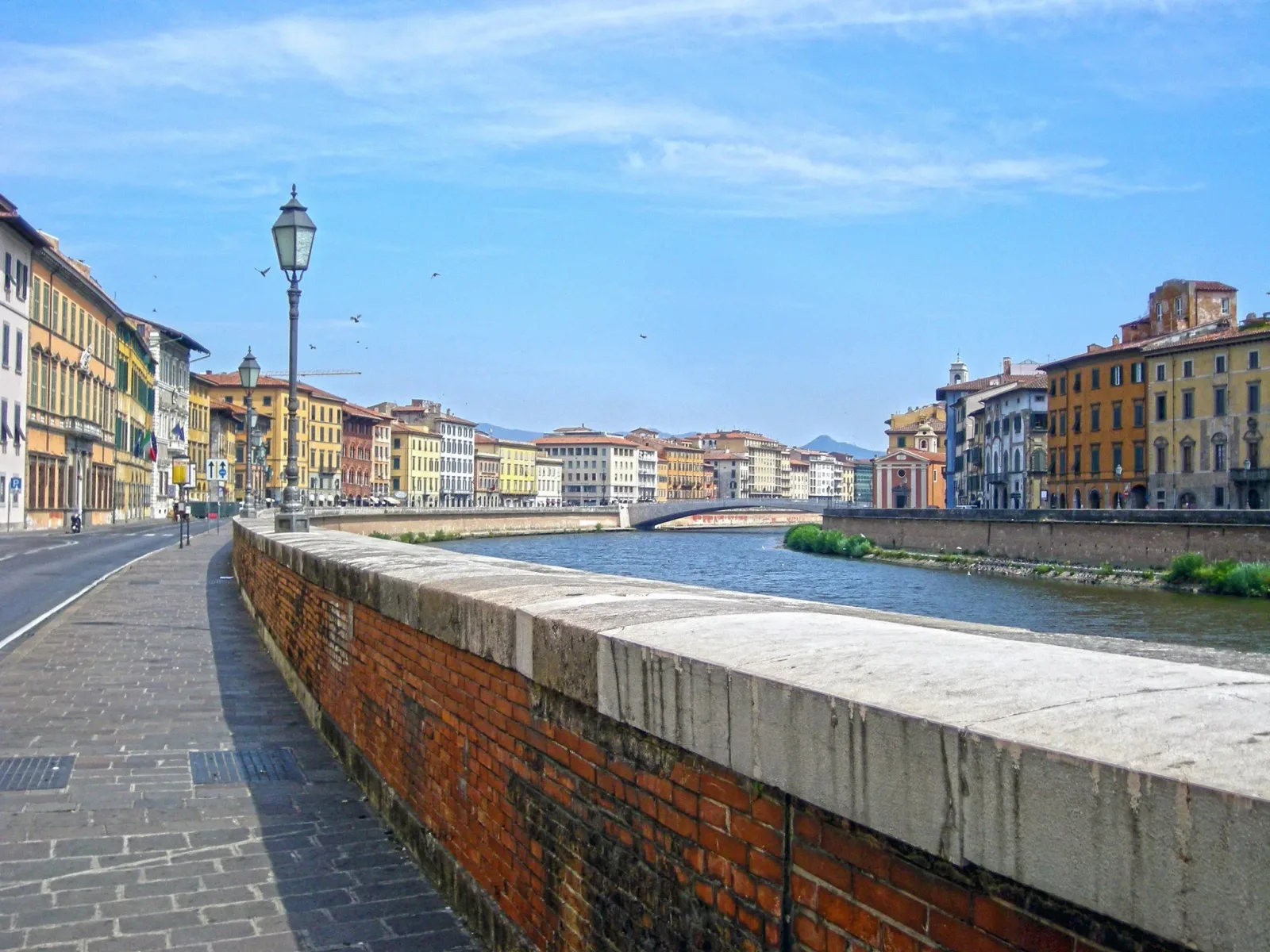
Pisa Lungarno, a contextual photograph, not a reconstruction of an earlier phase. Photograph: Albarubescens / Wikimedia Commons, CC BY-SA 4.0. Resized and recompressed without cropping; this adaptation is licensed CC BY-SA 4.0. No endorsement implied. Original photograph · CC BY-SA 4.0

River-linked settlements had different beginnings
Pisa's historical form cannot be explained by placing a cathedral and a civic square beside a river. Gabriele Gattiglia's archaeological study describes changing concentrations of settlement in a landscape shaped by the Arno, the Auser and less stable waterways and wet ground. The later city joined places with different beginnings. Their relationships changed before and after a larger enclosure brought more occupied ground within its limits. A shared boundary did not make every quarter the same age or give it one original plan.
The earlier geography is not completely recoverable. Gattiglia combines archaeological finds, environmental evidence, documents and spatial models, while explaining that the evidence is unevenly preserved and located. A modelled concentration is not an excavated building at every point. His account places an earlier urban concentration in a stronger relationship with the Auser, followed by a growing orientation towards the Arno. This is a qualified reconstruction of changing urban relationships, not a complete ancient street map.
The cathedral-side ground had its own development. Gattiglia describes religious concentration there while other inhabited places became more closely related to the Arno. Civic and productive activity also developed in different settings, including ironworking around the later Cavalieri area. These were not three finished districts assigned permanent religious, political and commercial labels. Institutions, work and housing overlapped, and the available evidence does not identify every building or prove a single coordinated arrangement.
Chinzica, south of the Arno, makes the differences harder to ignore. Its settlement was related to roads and a crossing, but continuity through every early phase remains uncertain. North of the river, the civitas and places described as outside it also had different relationships to enclosure and occupation. Physical separation, documentary names and participation in the wider city were not identical questions. The sources support several related concentrations more firmly than one founding event for all Pisa.
The later enclosure did not settle those relationships at once. Lucia Nuti's riverbank history compresses the union of the earlier nuclei around a mid-twelfth-century boundary, while Gattiglia distinguishes northern construction from a longer southern sequence. It would be misleading to give the entire enclosing circuit one completion year. More useful is the larger relationship: formerly distinct occupied places became part of a wider city whose density remained unequal and whose strongest commercial connections followed the river.
A commercial river belt connected different centres
Nuti identifies the banks as a connecting commercial belt rather than treating the cathedral precinct or civic ground as the only urban centre. Markets, landing places, shops, streets and residential fronts formed related parts of that belt. Smaller streets linked it with ground farther from the Arno. The river was therefore more than a boundary between two halves or a view in front of important buildings. It helped organise exchange and connections within the inhabited city.
That commercial concentration was articulated rather than uniform. Nuti's account distinguishes different markets and their relationships with the old bridge and river landings. Goods could pass between boats, bank-side trading places and streets leading farther into the town. Her detailed historical description draws in part on an earlier account transmitted through later scholarship. It should not become a new reconstruction of every stall, stair or cargo movement, or proof that the whole bank was one continuous public market.
The two sides did not have matching street and plot histories. Nuti contrasts greater regularity in parts of Chinzica with the less continuous pattern opposite, where earlier occupation and later reworking mattered. Gattiglia adds a longer sequence of occupation and changing plot organisation. Together, these accounts explain differences within a connected river city. They do not establish that every regular plot was laid out together or that one bank developed without earlier constraints.
The port relationship also exceeded a single monumental quay. Gattiglia's waterways discussion uses written and archaeological evidence to consider connections among the urban river, landing places and wider movement. The surviving record is incomplete, especially where timber structures could disappear. An absent excavated landing is not proof that no landing existed. Conversely, a likely river connection does not establish that a nearby house owned a working facility or that every cargo used the same route.
Houses and plots made the river city an inhabited place
The relationship between streets and commerce needs houses as well as markets. Gattiglia's housing discussion distinguishes changing materials and building forms, including structures made partly from perishable materials and later masonry construction. Timber and stone could coexist. A history told only through surviving towers and palaces would give disproportionate weight to the most conspicuous fabric and conceal less durable parts of the occupied city. The archaeological examples broaden the account without supplying a census of all Pisa's houses.
Residential densification was not simply a procession from scattered huts to identical stone towers. Gattiglia follows different building practices and changing use of plots, with older structures, additions and available ground affecting later arrangements. His account of Chinzica distinguishes earlier occupation from more ordered development. The sequence matters more than imposing one precise turning date or a standard original plot on the whole quarter. A later regular arrangement can contain several stages of building.
The excavated evidence around Via Uffizi shows the limits as well as the value of a particular house example. Gattiglia discusses two related tower houses and a proposed connection involving wooden elements. Excavation is partial, and aspects of the relationship and patronage remain interpretations. A later family's association with the property does not establish the earliest owners. The example supports a building group with connections and changes, not an unchanged medieval household reconstructed in full.
Materials also prevent a simple social map. Gattiglia discusses masonry techniques and the wider use of brick within changing building economies. His interpretations relate construction to differences in resources and social position, but they do not identify the income or occupation of every resident from a wall material. Nor does a tower's height prove one universal defensive function. The firmer architectural point is that houses varied, developed within plots and could combine different materials and construction phases.
Later riverbank palaces did not necessarily replace earlier residence with an entirely new building on an empty site. Nuti describes merchant towers and tower houses joined into larger aristocratic premises. Read beside the archaeological housing evidence, this connects the later bank-side frontage with earlier inhabited fabric. A more coherent facade can cover a less uniform history behind it. It does not establish unchanged interiors, continuous family ownership or the voluntary participation of everyone affected by the remaking.
The banks changed through successive uses and works
Nuti follows a gradual reorientation of the Lungarni towards residential, representative and scenic roles. Market displacement and institutional building were part of that change: the grain-market setting gave way to university premises, while food trading moved elsewhere. These were changes within an existing commercial city, not proof that all exchange ended or that education created the surrounding settlement. The order and pace of particular removals matter more than a single turning point from trading river to elegant promenade.
The reworking was selective and contested. Nuti describes demands that certain noisy or unwelcome trades should leave a setting increasingly associated with elite display. Shop removal happened in stages, while rebuilding after a bridge collapse accelerated part of the process. A cleared frontage therefore records choices about which activities should remain visible. It cannot establish public agreement or prove that every trader found an equally useful replacement elsewhere.
Promenade use did not immediately eliminate work beside the river. Nuti records festive and recreational presentation alongside continued unloading and proposals concerning landing places. The banks could support overlapping uses during a period of change. Her account of an approved landing project in 1849 is not, by itself, a completion record. Distinguishing activity, proposal and executed work prevents a false picture of one moment when commercial contact disappeared from the entire river.
Nineteenth-century intervention changed the physical relationship again. Nuti separates Bellini's approved 1865 project, a small part undertaken in 1866, later decisions and broader schemes. Raising and aligning bank-side ground and changing walls, stairs and landings affected how the city met the Arno. The source does not establish that every component of every proposal was built. Its historical discussion of floods should not be converted into a present assessment of hydraulic performance or protection.
Santa Maria della Spina's dismantling and higher rebuilding belongs within that history of changed levels and riverbank presentation. It is one consequence of the wider reworking, not an explanation of the whole city's formation. Nuti's forceful description of separation between river and city is most useful as an interpretation of lost earlier relationships. It should not be read literally as the end of every human connection with the Arno.
Civic premises followed a different institutional history
Piazza dei Cavalieri did not begin as a Renaissance composition on vacant ground. The municipal history describes earlier political and working activity and the joining of pre-existing buildings for communal premises. Vittoria Brunetti's introduction likewise explains how the later Carovana retained inherited structural fabric beneath a more regular presentation. The civic setting had a history distinct from the river markets, even though both belonged to the same city and both underwent later change.
The Medici and the Order of Santo Stefano gave that ground a different institutional role. The Scuola Normale's historical account describes Vasari's projects and work continuing under later patrons. The square's buildings and sides did not all reach their later form together. Different construction spans in the municipal and institutional summaries should not be forced into one finishing year. A recognisable composition can result from successive campaigns involving earlier premises, new work and further alteration.
The western properties help prevent an overly unified account. Brunetti and the institutional history distinguish residential premises, later uses and different ownership relationships around the square. Not every building belonged to the same institution throughout its history. A related frontage did not turn all properties into one holding, and a change of institutional name did not rebuild every wall. The useful relationship is between inherited premises and changing authority, not the substitution of one complete city for another.
Carovana's later association with the Scuola Normale, beginning in 1846, adds another stage rather than closing the history. Brunetti introduces the different owners and bodies involved in later protection and restoration. The institutional account also acknowledges decoration lost or heavily reworked. These histories do not establish present ownership, operation or access to every building. They show why even a coherent civic setting should be understood through reuse and intervention rather than treated as an intact moment.
The cathedral setting was remade rather than simply uncovered
The cathedral precinct had a different relationship again. UNESCO describes monuments with distinct religious functions forming an ensemble. Alessandro Melis and Julia Gatley examine the nineteenth-century recasting of their setting, including removal of ancillary buildings, changed perimeter premises and expanded grassed open ground. Their interpretation is an idealised medieval landscape made through later intervention, not a newly discovered medieval lawn. The medieval monuments and the history of their later presentation need separate explanations.
Keep proposals and successive work apart here too. Melis and Gatley distinguish Gherardesca's scheme from later phases associated with Bellini. Their argument about architectural ideas is not proof of every proposed alteration or a demonstrated personal connection with English designers. They explicitly identify missing evidence for some relationships. UNESCO's language about retained qualities and spatial relationships likewise does not mean that every ancillary structure, edge or piece of open ground survived without change.
Pisa becomes clearer when these different transformations remain connected. River-linked settlements and changing houses formed an inhabited commercial city; successive bank works altered its exchange and presentation; civic premises acquired different institutional roles; and the cathedral precinct received a remade open setting. These were related histories, not one improvement programme or a single disappearance of the old town. Published research supports this interpretation, not a present-condition survey, an exact reconstruction of every property or a verdict on every resident's experience.
Sources
- Lucia Nuti, I Lungarni di Pisa: da centro commerciale a passeggiate,2008, printed pp245-252. Complete eight-page text read, not original cited archives or figures.
- Gabriele Gattiglia, MAPPA. Pisa in the Middle Ages: archaeology, spatial analysis and predictive modeling, Edizioni Nuova Cultura, copyright2014. Complete waterways pp69-74, method pp82-85, selected earlier-city passages pp86-89,96-106, complete later-medieval city pp107-117 and houses pp131-143 read, not the full book or original field records.
- Alessandro Melis and Julia Gatley, A romantic in Tuscany,2018. Complete section4 pp7-11, limitations section6 and conclusions section7 throughp17 read, with abstract and selected other passages, not complete article, notes, references or figure pixels.
- Vittoria Brunetti, Pisa restaurata. Viaggio nella storia della tutela di Piazza dei Cavalieri, first edition December2025. Title, copyright, contents and complete introduction pp11-15 read, not later case chapters, original archives or figures. The2026 hosting path is not the publication date.
- Comune di Pisa, Piazza dei Cavalieri, historical main entry attributed to G.Gattiglia and M.Zampetti. Complete historical main text read; unrelated nearby services and event widgets not used.
- Scuola Normale Superiore, Piazza dei Cavalieri. Complete returned main-page text read, not separate linked subtopics, interactive plan or image pixels.
- UNESCO, Piazza del Duomo, Pisa. Complete English synthesis, criteria, integrity, authenticity and management text read, not all linked documents or images. Institutional descriptions are not a new survey.
Questions people ask at the gate
Was Pisa simply an ancient street plan preserved around its cathedral?
No. Gattiglia's archaeological account describes changing settlement concentrations and a growing relationship with the Arno, while recognising incomplete and uneven evidence. The cathedral-side ground, other nuclei and later enclosure did not all share one beginning. Modelled distributions are not a complete excavated street plan.
Did the riverbanks and civic square perform the same role?
No. Nuti distinguishes the commercial river belt from the civic and religious concentrations. Markets, landings, streets and houses connected the banks with the wider city, while civic premises had their own institutional history. The places were related without being interchangeable centres.
Were Pisa's medieval houses all stone towers?
No. Gattiglia discusses varied materials, smaller buildings, changing plots and construction phases. Timber and masonry could coexist. The Via Uffizi example is partial excavated evidence with interpreted connections, not a complete model of every house or household.
Did promenade use replace river commerce in one operation?
No. Nuti describes successive market and shop changes, selected activities, promenade presentation and continued unloading. Later bank projects and executed work also need separate descriptions. Approval of a scheme is not proof that every part was completed.
Did Vasari create the civic square on empty ground?
No. Earlier political and working ground, aggregated premises and inherited building fabric preceded the later Order setting. Successive work, different properties and later educational and restoration histories prevent treating every edge as one completed Renaissance commission.
Is the cathedral precinct's open lawn an untouched medieval setting?
That description is too simple. Melis and Gatley interpret the nineteenth-century removal and reworking as an idealised medieval landscape. The monuments' medieval origins and the later presentation of their surroundings are different histories. Their study does not establish every proposed work, direct personal influence or present condition.
Next walk starts at a new gate.
Was this helpful?
one tap, no sign-up

A Miranda House graduate and lawyer who traded courtrooms for slow travel. Cheshta travels with the batches we host ourselves, with a soft spot for travelling alongside elders.